Credit: yohanes budiyanto, CC BY 2.0, via Wikimedia Commons
We often hear that sea level is rising, but less often that cities are sinking—which may put them in more jeopardy.
This may be caused by land rebounding from the last ice age, when it was covered by ice sheets. While some areas spring upward, others that were pushed upward around the periphery of ice sheets are slowly sinking.
Or, Earth's surface may rise or fall when a fault slips, or tectonic plates subduct under or slide over other plates.
Rivers move sediment to deltas where, over many years, they may accumulate so much weight they depress Earth’s crust. Normally, floods carry new sediment to replenish the sinking land, but human flood control measures, like levees, distort that.
Our large cities, made of concrete and steel, can become so heavy that they start to sink.
But the removal of fluids from the subsurface turns out to be the leading reason that land around cities subsides.
Scientists surveyed 100 coastal cities and found that a third of them were sinking more than half an inch a year—mostly because of groundwater extraction.
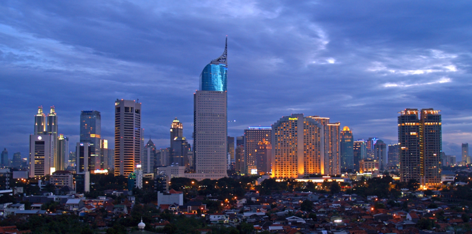
The fastest sinking city is the Indonesian capital of Jakarta; some neighborhoods are subsiding almost one foot per year.
By comparison, global sea level is rising about an eighth of an inch a year. But the combination of sinking land and rising seas makes some coastal cities quite vulnerable.
Background
Synopsis: Future flooding from sea levels that have been rising since the last ice age is a concern for coastal cities, but many of these population centers have an added worry—their land surfaces are subsiding at alarming rates. Locally, the causes of subsidence differ and can be attributed to both natural processes and human activities. The worst case is Indonesia’s capital city, Jakarta, with parts of the city sinking as much as 10 in (25 cm) per year.
- In places, the land at Earth’s surface undergoes slow vertical motion as it sinks, shifts or uplifts on the order of millimeters to centimeters per year, from combinations of both natural processes and human activities.
- One natural process that results in vertical motion is the isostatic adjustment that is still ongoing after the last glacial maximum. Areas buoyed up along the edges of ice sheets (similar to how an air mattress bulges up when you sit on it) are very slowly subsiding to their pre-ice-age elevations, while previously depressed areas continue to rebound upward.
- Fault slip may produce elevation changes in tectonically active areas, where earthquakes and volcanic activity may be common.
- While bedrock tends to be a sturdy substrate for inland cities, coastal cities tend to be built on sandy features like barrier beaches and deltas that are prone to sediment compaction and subsidence. Deltas sink naturally under their own tremendous weight, with flood sediments replenishing them.
- Additionally, diversion of natural drainages by human-made levee systems prevents natural flooding and replenishment, starving these huge dynamic geological systems.
- The sheer weight of concrete and steel in urban infrastructure can cause subsidence and flooding.
- Human-caused subsidence can occur from water production as emptied void space in shallow aquifer sediments compacts.
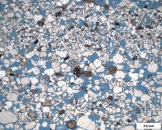
Photomicrograph of a sandstone with blue epoxy filling its pore space. If saturated, these pores would be supported by water, but empty voids can collapse and cause subsidence.
Credit: Michael C. Rygel, CC BY-SA 3.0, via Wikimedia Commons - While extraction of fossil fuels can have a similar effect, most oil and gas reservoirs are too deep to impact the surface. Deeper rocks tend to be stronger because they are already compacted.
- However, shallow injection of waste water produced with hydrocarbon extraction can result in local uplift of the ground surface.
- Scientists use satellite-based remote sensing to capture records of vertical motion with centimeter to millimeter resolution on a global basis.
- Synthetic aperture radar (SAR) uses electromagnetic signals in the radio and microwave range that penetrate clouds and darkness.
- Some satellites capture SAR imagery about once every 12 days, providing a dynamic view of land surface motion at low cost.
- Interferometric SAR (InSAR) bounces radar signals off the ground in successive orbits and determines tiny phase differences between successive passes that result in constructive or destructive wave interference indicating uplift, subsidence, or lateral motion.
- Recently, scientists compared 2020 InSAR data to 2015 data for 99 coastal cities and noted subsidence rates of more than 0.4 in (1 cm) per year for a third of them.
- With a 30-year record of satellite measurements, the rate of global sea level rise has been documented at 0.13 inches (3.4 millimeters) per year, largely supporting the steady rate of rise recorded by sea level monitoring stations during the past century (ED-317 Swelling Seas).
- Coastal subsidence is not a direct result of climate change, but it will accelerate and amplify the impact of steadily rising sea levels.
- The most rapid subsidence rates were found in Asia, but North America, Europe, Africa and Australia also include cities with fast subsidence.
- While subsidence is highly variable within these populous areas, most of it can be tied to groundwater extraction, impacting up to 59 million coastal residents.
- Monitoring subsidence and limiting contributing human activities will be required to minimize the potential of flooding in these vulnerable regions.
- The worst case is Indonesia’s capital, Jakarta, with parts of the port city sinking as much as 10 in (25 cm) per year.
- Today, 40% of the city is below sea level, protected by a 6 ft (2 m) seawall.
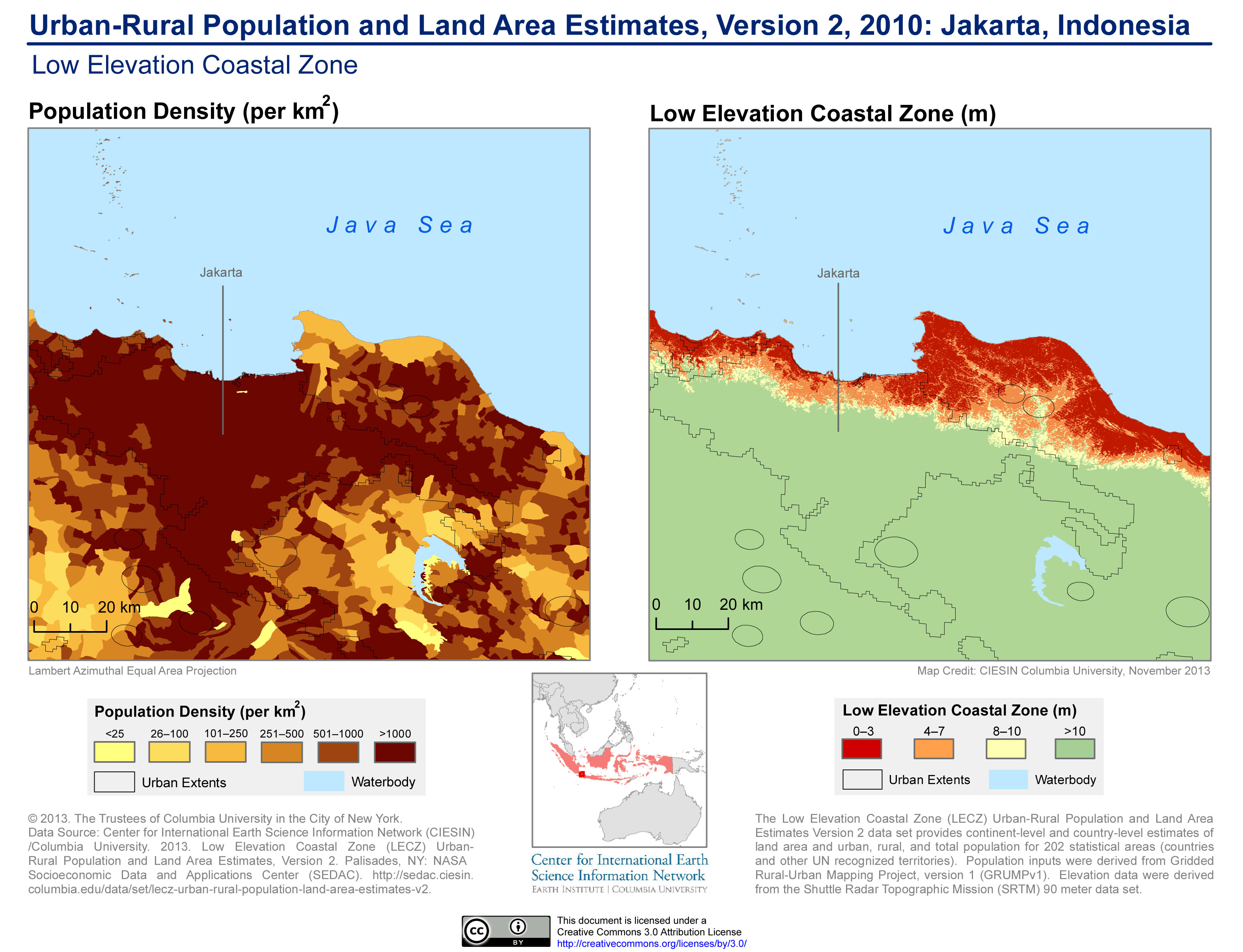
A comparison of Jakarta’s population density with Low Elevation Coastal Zone (LECZ) topography shows Jakarta’s vulnerability to flooding disasters.
Credit: SEDACMaps, CC BY 2.0, via Wikimedia Commons - The principal cause of Jakarta’s subsidence is groundwater overextraction on a massive scale, driven by inadequate and polluted surface water supplies.
- Jakarta is built on a soft-sediment delta fed by 13 rivers, an environment naturally characterized by floods and subsidence, especially under the weight of the city’s infrastructure and skyscrapers.
- Because of the subsidence, future projected seawater incursion in Jakarta can’t be mitigated by just building a seawall, so the Indonesian government has been compelled to create a plan to establish a new capital more than 1,000 mi (1,614 km) away, on the island of Borneo, by 2045. But that still leaves 11 million residents behind.
- At the current rate of subsidence, more than a third of the city could be submerged by 2050. But the good news is that recent strict management of groundwater extraction has appears to be slowing subsidence rates.
- Today, 40% of the city is below sea level, protected by a 6 ft (2 m) seawall.
- Thirty-three of the surveyed cities were subsiding at rates of 0.4 in (1 cm) per year or faster, that’s three times the rate of global sea level rise.
- Other Asian cities such as Bangkok (Thailand), Dhaka (Bangladesh), Shanghai (China), Ho Chi Minh City (Vietnam) and Manila (Philippines) also struggle with subsidence from groundwater extraction and soft sediment compaction beneath urban infrastructure.
- Houston (Texas) and New Orleans (Louisiana) are also sinking because of sediment compaction and groundwater extraction.
- In Italy, Venice (ED-038 Venice Holds Back the Sea) has been sinking into its lagoonal sediments for centuries, driven by subsidence from groundwater extraction and the weight of its historic buildings.
- Although it is not on the coast, Mexico City was built on a dried-up lakebed, and groundwater extraction from underlying aquifers has caused more than 12 in (30 cm) of subsidence in some parts of the city in some years—even more than in Jakarta taken as a whole. Seismic activity adds to the hazards of living in Mexico’s capital city.
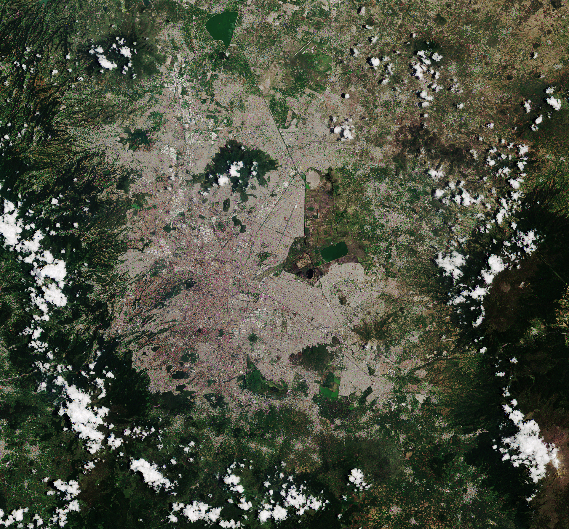
Home to nearly 9 million people, Mexico City is the densely populated, high-altitude capital of Mexico. Sentinel’s optical camera clearly shows the difference between the densely built city center and the vast surrounding vegetation.
Credit: Contains modified Copernicus Sentinel data, CC BY-SA 3.0 IGO, via Wikimedia Commons
- New York City is sinking at about half the rate of sea level rise, but scientists attribute its motion as an isostatic response to the weight of Pleistocene ice sheets from thousands of years ago.
- When ice sheets depressed the continent below them, the area along their periphery popped up.
- Now the process has reversed, and the coast is subsiding in response to what is known as “glacial rebound” as the continent takes thousands of years to relax to its original elevation.
- Some researchers have attributed the subsidence to the weight of New York’s urban infrastructure, but while some are built on land fill, most the skyscrapers are built on solid bedrock.