A recent discovery has reshaped our understanding of human history in North America.
A few EarthDates ago, we talked about a tribe of Siberians who were stranded in the Bering Strait for centuries before migrating into North America to become its first citizens 16,000 years ago.
Turns out, they weren’t first. Because in White Sands National Park, scientists have found something remarkable.
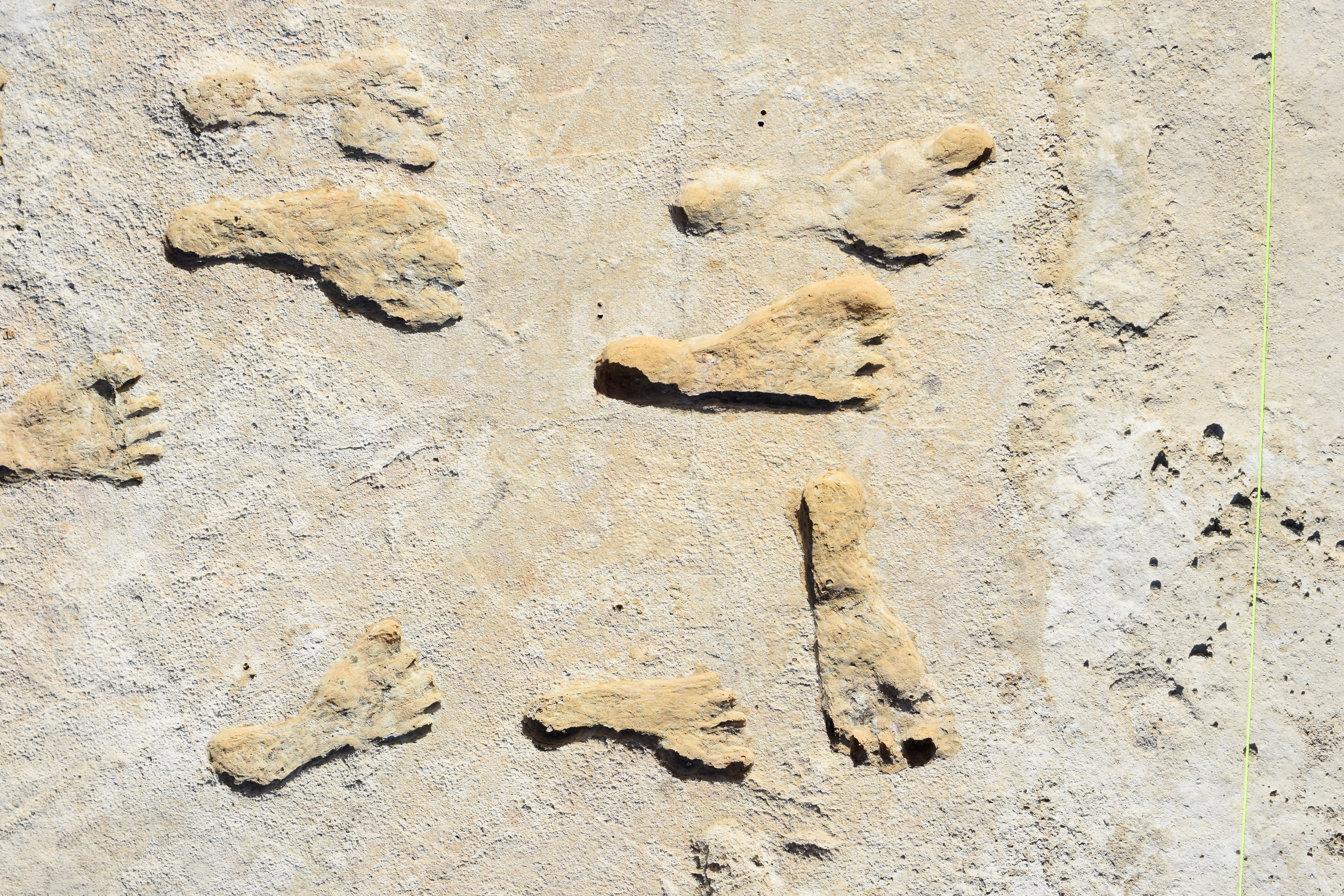
Modern visitors to this dry southeastern corner of New Mexico, who happened to come during one of its rare rainy spells, sometimes reported seeing “ghost footprints.” But they would disappear when the sands dried again.
In 2016, archaeologists were finally able to locate and carefully excavate a large number of these footprints around an ancient dry lake. Then, they used radiocarbon dating on grass seeds found with the prints to determine their age—and were stunned by the results.
Humans lived in the area between 23,000 and 21,000 years ago—5,000 years before the Beringians arrived.
The researchers found dozens of prints, from small children to older adults…who these people were is a mystery—at least for now.
The field of paleoanthropology continues to produce new riddles and new answers in our quest to understand our past.
The White Sands people will certainly play a role in that.
Background
Synopsis: White Sands National Park is best known for its huge expanse of incredibly white gypsum sand dunes near the infamous White Sands Missile Testing Range. But it also harbors a recent discovery that will rewrite human history. Layers of gypsum lakeshore deposits reveal human footprints ranging from 22,800 to 21,130 years old, which would have been near the end of the last glacial period of the Pleistocene Epoch. Dated by seeds in layers above and below the footprints, the timing of repeated human activity around the ancient lake is more than 5,000 years prior to other archaeological records and suggests that humans migrated to North America before glaciers blocked southern paths from Beringia.
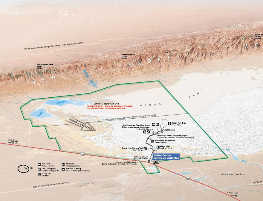
- White Sands National Park is in south central New Mexico’s Tularosa Basin, between Hatch and Alamogordo, due north of El Paso, TX.
- More than 250 million years ago, during the Permian Period, a shallow sea covered parts of Texas, New Mexico, Oklahoma, and Kansas.
- Repeated periods of evaporation produced extensive evaporite deposits in the basin including halite and calcium sulfide deposits like gypsum and anhydrite.
- These beds were exposed around 70 million years ago as mountains formed in western North America from Canada to Mexico during the Laramide orogeny.
- Around 30 million years ago, changing tectonic forces caused the Tularosa Basin to form as part of the Rio Grande Rift.
- By the start of the Pleistocene Epoch 2.58 million years ago, the paleo-Rio Grande River eroded its way into the north–south elongated depression, bringing mineral-rich sediments from nearby mountains that eventually filled the basin to form Lake Otero, which at 1,600 mi2 (4,150 km2) was about the size of the U.S. state of Rhode Island.
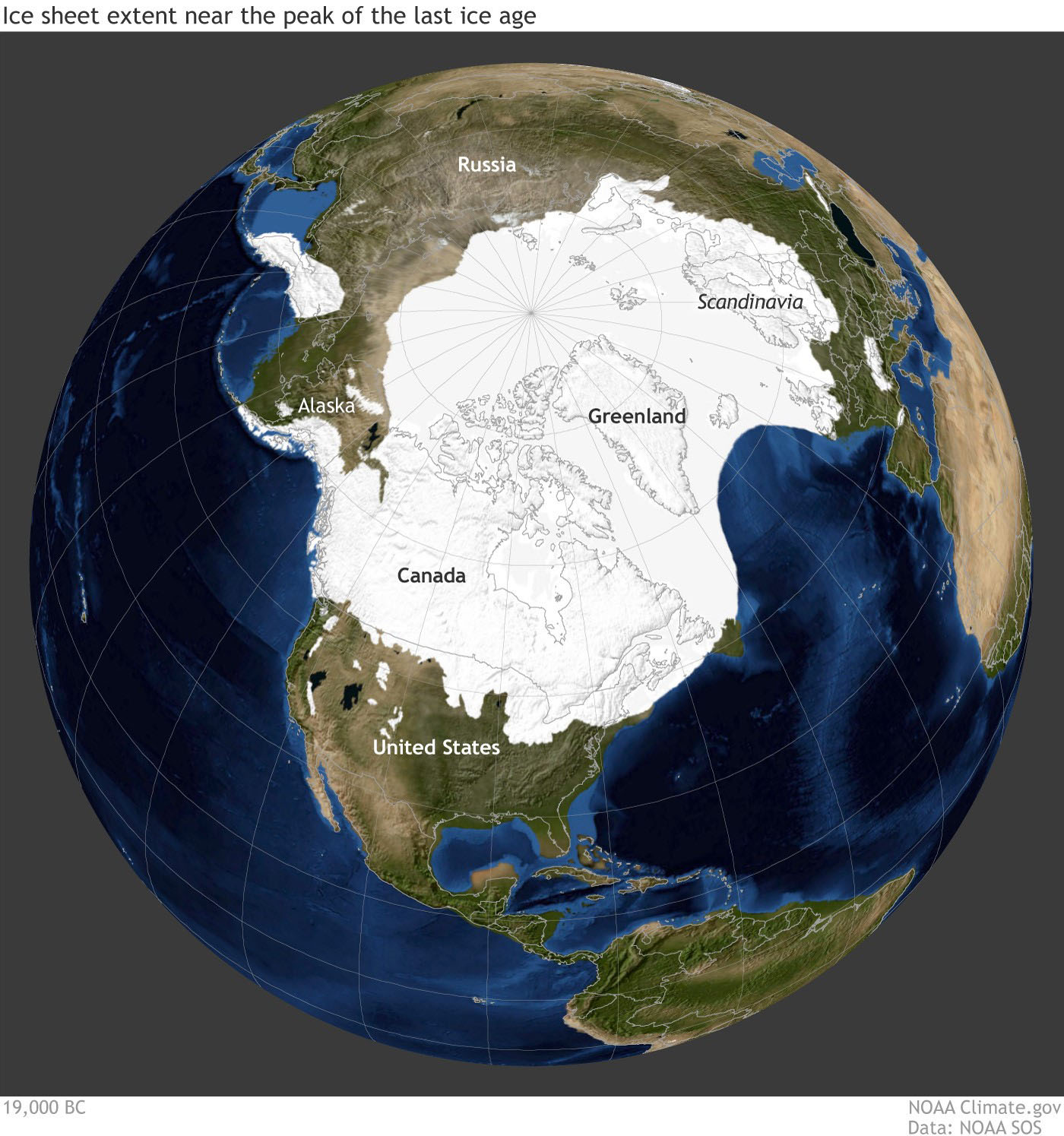
- Between 26,500 to 20,000 years ago, the final Pleistocene ice sheet reached its maximum southward extent known as the Last Glacial Maximum (LGM).
- The boundary of the massive ice sheet roughly followed the route of today’s Missouri River in Montana and the Dakotas, turning east through central Iowa.
- Although the edge of the ice sheet was more than 800 mi from the Tularosa Basin, the climate became much colder and wetter there.
- As the Pleistocene ice age ended, meltwater from continental glaciers flowed south filling lakes like Lake Otero.
- By the start of the Holocene Epoch 11,700 years ago, conditions became drier, and Lake Otero began to evaporate, becoming a huge dry lakebed with a smaller lake called Lake Lucero at its south end.
- Evaporation caused large gypsum crystals to form on the dry surface of the playa, now named Alkali Flats.
- Strong prevailing winds from the west eroded the crystals into tiny, frosted grains of gypsum, which form 275 mi2 (712 km2) of bright white dune fields.
- Every 10–15 years, floods refresh the water in the playa, initiating the growth of new gypsum crystals that erode to enhance the famous white sand dunes.
- While the national park is well known for its brilliant gypsum White Sands, recent discoveries on the banks of paleo Lake Otero have rocked the anthropological world, placing humans in the Americas 5,000 years earlier than previous findings could support.
- Theories of human migration suggest humans migrated from Africa to Europe and Asia between 195,000 and 65,000 years ago, reaching Australia about 60,000 years ago and Siberia about 32,000 years ago.
- EarthDate episode ED-057 describes research regarding human migration to the Americas from Siberia via a land bridge known as Beringia. Human DNA shows these humans were isolated in Beringia while walls of ice in Alaska blocked any eastward migration from about 23,000–16,000 years ago.
- The oldest fossil evidence of humans in both North and South America suggests their arrival around 16,000 (Texas) and 18,500 (Chile) years ago, suggesting earlier possible travel routes along the Pacific coast.
- For eighty years, visitors to the White Sands had noted ghost footprints that appeared in rare wet weather events in lithified silt and clay outcrops along Lake Otero’s shores only for them to disappear as the rocks dried out. A few footprints were excavated in 2009.
- Then, in 2016, researchers from the United States Geological Survey (USGS) radiocarbon-dated ditchgrass seeds in layers above and below the excavated footprints. These prolific lakeshore plant seeds also occurred within many of the footprints.
- They determined the tracks were formed between 22,800–21,130 years ago in a dry phase during the final peak of Pleistocene glaciation, extending the history of humans in the Americas by at least 5,000 years.
- If these humans entered the Americas via the Beringia land bridge, it must have been before the ice walls blocked travel or via coastal Pacific routes.
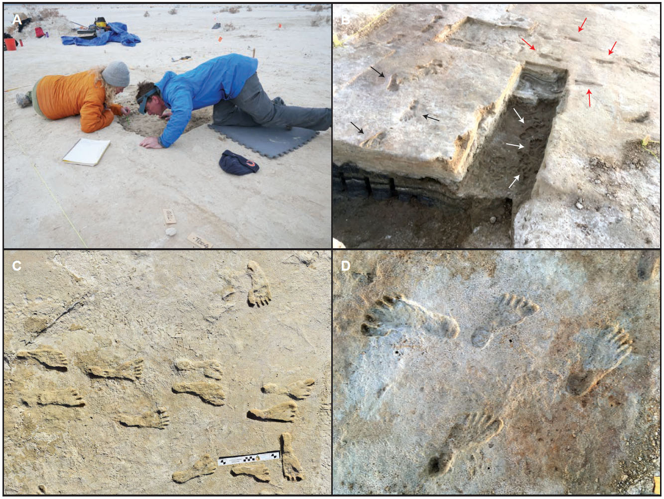
- Thousands of tracks occur all over the eastern part of the park along the paleo lakeshore in multiple layers that represent around 2,000 sustained years of human visitation.
- The footprints vary in size from those of small children to teens and adults engaged in chores and play along the lakeshore.
- The layers also include tracks of mammoths, giant sloths and wild camels that fed along the lush shoreline, along with predators like dire wolves and American lions.
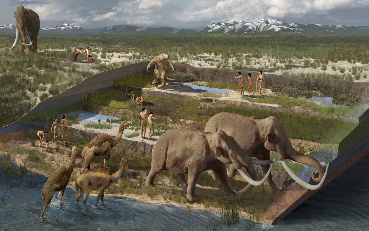
- The story of human migration continues to amaze and challenge researchers, and the image of humans living and playing along the shore of ancient Lake Otero at the height of the Pleistocene ice age provides a key chapter.