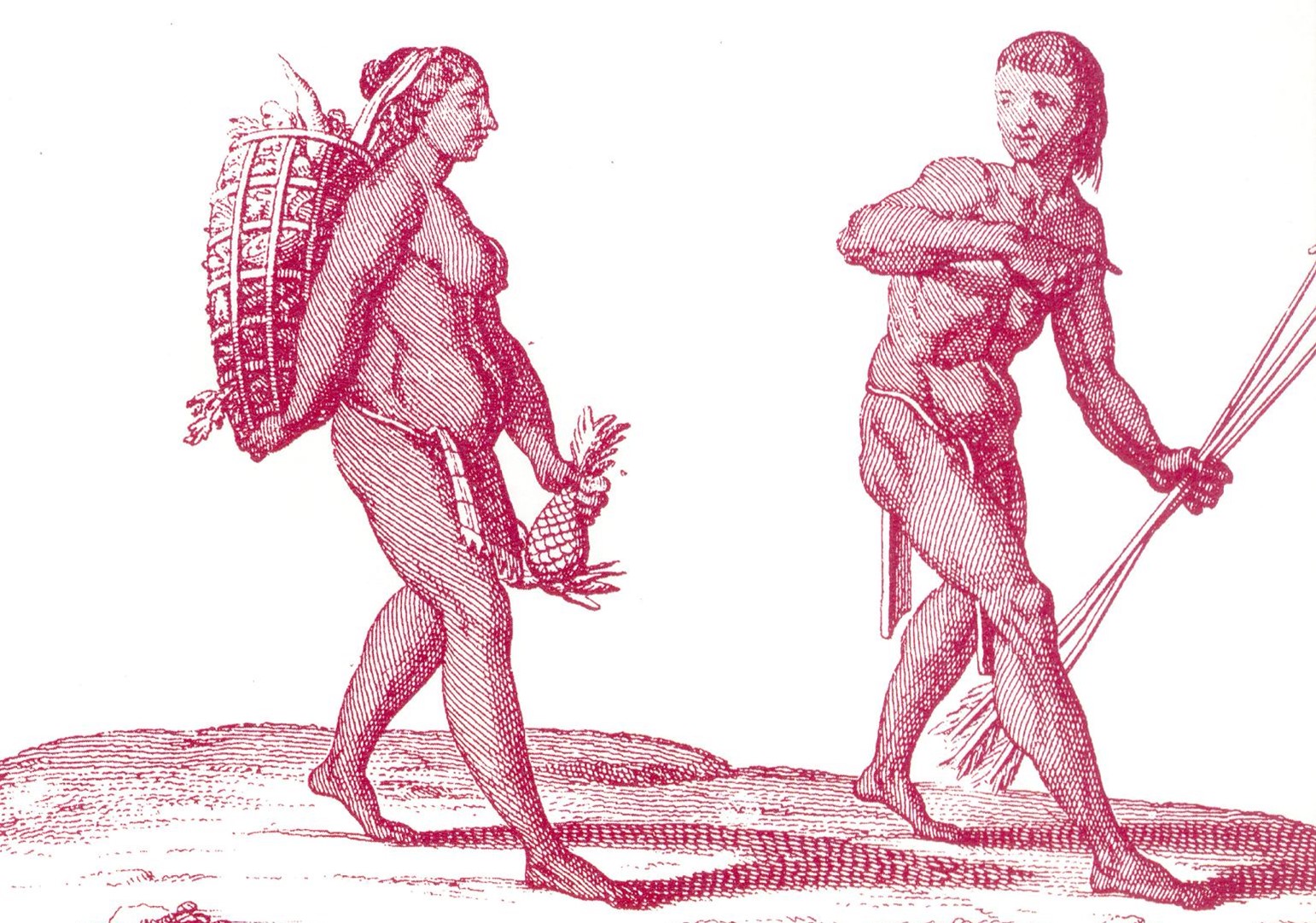
Credit: Pierre Barrère, public domain, via Wikimedia Commons
Background
Synopsis: Long before the rise of the great Mayan cities, ancient people were transforming the landscapes of Central America in ways we’re only just beginning to understand. New discoveries buried beneath the wetlands of Belize reveal a story of innovation, resilience and ecological mastery, inviting us to rethink our understanding of early civilizations.
- Across northern Belize, located on the northeast coast of Central America, lie vast stretches of wetlands. Swamp-loving mosquitoes and hot, muddy conditions create a world that looks far from inviting.
- Yet thousands of years ago, people did not avoid this landscape. In fact, they transformed it.
- You might first think this would be the Mayans with their monumental cities and cultural advancements, but there were others who inhabited this area.
- Preceding the Mayans, the Late Archaic hunter-gatherer-fisher groups roamed this landscape roughly 8000 to 2000 BCE. Often considered simple foragers and hunters, new research shows this group developed key advances that laid the foundation for the more complex societies in Mesoamerica, including the Maya.
- The Mesoamerican region stretches from central Mexico through much of Central America, including present-day Guatemala, Belize, Honduras and El Salvador.
- The landscape features a wide variety of environments including mountain ranges, tropical forests, dry highlands, volcanic valleys, rivers and coastal plains.
- Seasonal climate patterns, especially the alternating dry and rainy seasons, shaped how ancient peoples settled and used the land.
- In the lowland regions, such as northern Belize, seasonal wetlands dominate the landscape appearing as swampy, waterlogged terrain for part of the year, and drying out during other times.
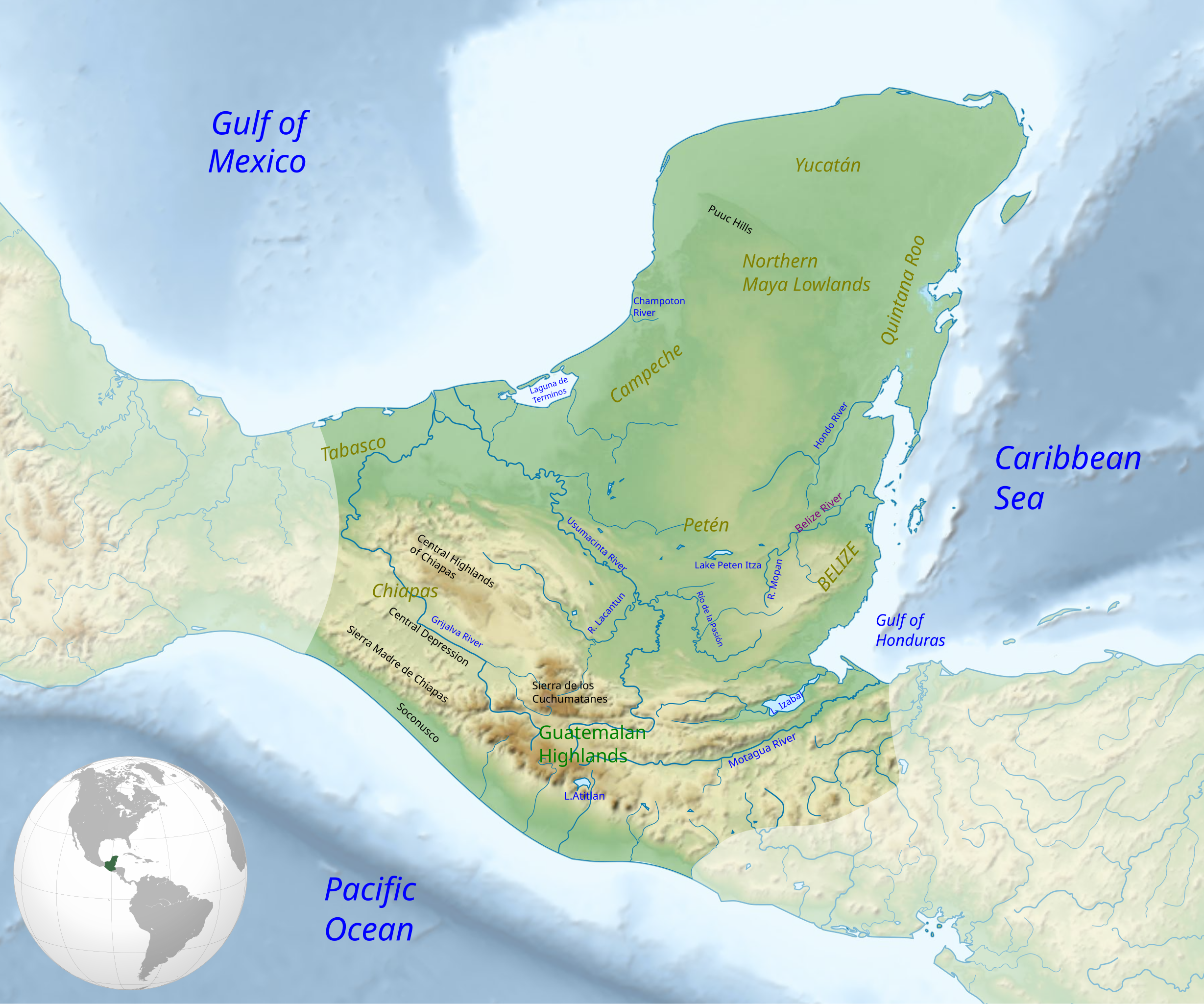
In the eastern part of the Yucatan Peninsula, the seasonal wetlands in Belize have been occupied for thousands of years.
Credit: Simon Burchell, via Wikimedia Commons
- For decades, researchers had noticed that the wetlands in this region had been modified to include many linear features, presumably by the ancient Maya due to the proximity to the Mayan center of Chau Hiix.
- Many believed these channels were designed for water collection and used primarily for agriculture, all credited to Mayan advancements.
- Studying these areas is often challenging as they are often partially or fully submerged, making ground level studies difficult.
- Yet once again, technology has provided a new opportunity to study these remote locations and hidden wonders.
- A team of researchers from the U.S. used lidar data from Google Earth images along with drones during the dry season to explore the linear features. An extended period of drought also allowed them to access areas that would have normally been formidable. What they found was incredible.
- Lidar (Light Detection and Ranging) helped “see” through the wetland vegetation, revealing hidden geometric patterns. (Lidar use in archeology is a growing trend as mentioned in a previous EarthDate episode on the Egyptian pyramids.)
- Combined with drone imagery, satellite photos and on-site excavation, researchers could build a full picture of the ancient system.
- A network of canals, sometimes hundreds of meters long, was revealed, along with ponds that were possibly used for water storage, cultivation of aquatic plants or fish farming.
- The people selectively raised the land and dug canals to control water levels, key to surviving the wet and dry seasonal shifts.
- Fish traps made of earth ridges or possibly wooden fences used the created water channels to direct fish movement.
- During the wet season, water floods the Belize wetlands and lagoons, creating ideal locations for fish to spawn. During the dry season, the human-built canals would route the aquatic life, including fish, turtles and mollusks, into pools.
- Carbon dating revealed that these structures were constructed between 1800–900 BCE, making them some of the oldest aquatic systems in the Americas.
- Archeological finds of spears near the ponds give evidence that these engineers knew the easiest way to catch a fish—gather them into a smaller tank.
- Even today, locals report that the ponds still concentrate fish when seasonal floodwaters recede.
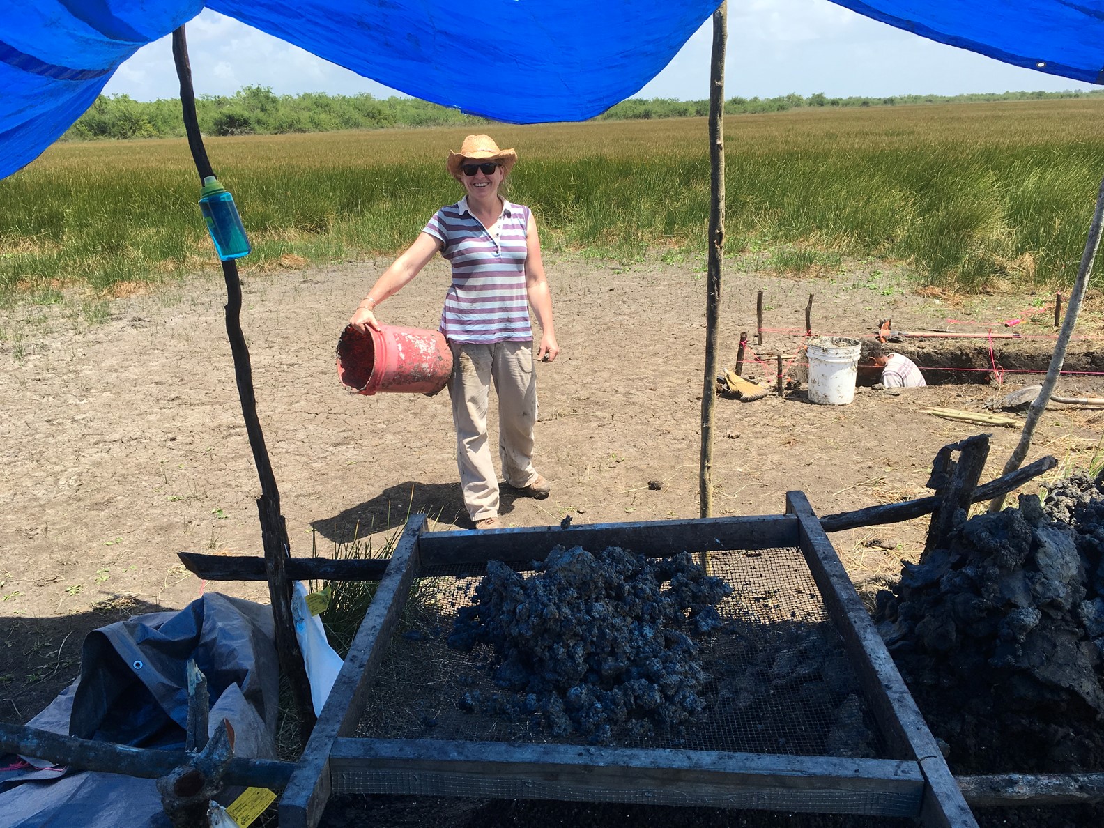
Dr. Eleanor Harrison-Buck performing wetland excavations in the Crooked Tree Wildlife Sanctuary.
Credit: Belize River East Archeology (BREA) project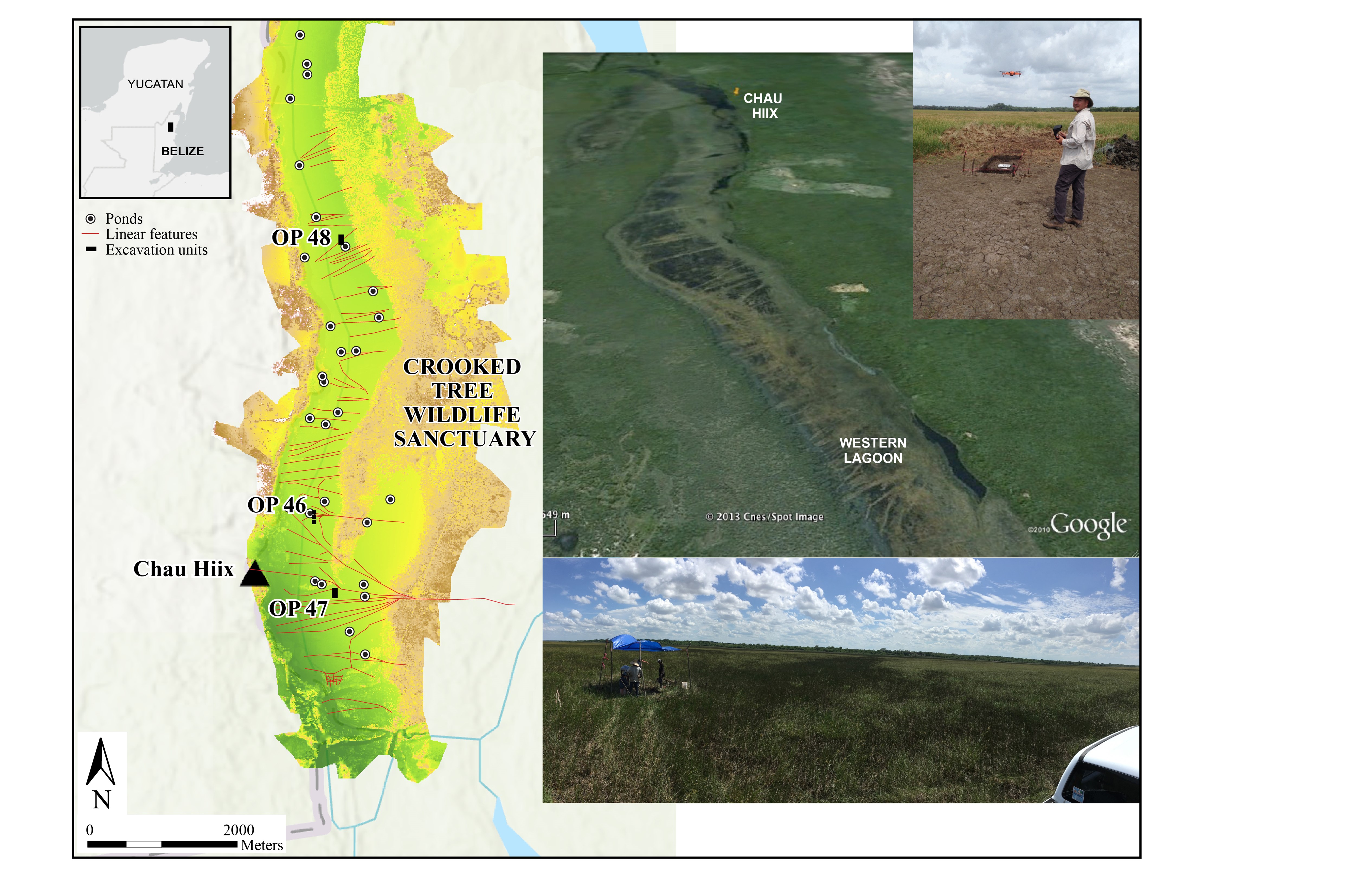
Map (left) showing digital elevation model of the wetland lagoon in the Crooked Tree Wildlife Sanctuary produced with drone imagery by Mr. Mark Willis, BREA drone operator (shown in top right). Geospatial analysis of the imagery and mapping of the linear canals and ponds was produced by Dr. Marieka Brouwer Burg, BREA co-Director (University of Vermont), and the geomorphological testing of the canals (bottom right) was led by Dr. Samantha Krause (Texas State University). Paleobotanical analysis for this research was carried out by Drs. Angelina Perrotti and Katie Bailey (PEARL and UVM).
Credit: Belize River East Archeology (BREA) project
- Analysis of canal sediments showed that many contained charcoal, suggesting burning of wetland plants to prepare the area for use and restore nutrients to the soil for the growth of specific plants.
- A lack of maize pollen in addition to the carbon isotope analysis leads researchers to believe that maize cultivation did not occur in the area as was present in the later Mayan communities.
- In this region that encompasses the current Crooked Tree Wildlife Sanctuary, no true ditched and drained agricultural fields have been identified, further acknowledgment that the linear, zig-zag channels served primarily as large-scale fish trapping facilities.
- Stone bowls and pestles found near canals provide support that the region was also used to grow some native plants including Amaranthaceae, a nutritious grain that would thrive under drought conditions and on the disturbed channel banks.
- With both aquatic and horticulture management techniques, this variety gave the people a resilient food system, one that could adapt to changes in rainfall, storms and seasonality.
- These primary food systems were able to support a large population, with some estimating as many as 15,000 people in the region. An ample food supply would thus promote the formation of social gatherings and communal events, leading to changes in the nomadic hunter-gatherer lifestyle and supporting sedentary populations in the region.
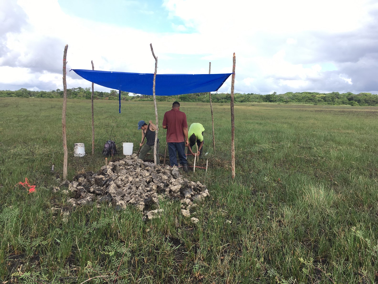
Researchers excavating sediment that will be sequenced to help them date the evidence of a large-scale pre-Columbian fish-trapping facility.
Credit: Belize River East Archeology (BREA) project
- At a time when many locations in the world struggle with water management, changing climate and sustainable food production, the ancient engineers of Belize have something to teach us.
- They worked with the land, not against it. They blended agriculture with aquaculture, balancing productivity and biodiversity. And they did it without the heavy machinery or chemical inputs we rely on today.
- Just as a recent EarthDate episode on ancient heating and cooling systems explained, we can look to the past to find new tools to solve modern world challenges.
- We should never accept the idea the ancient people were less capable than we are today. The fish traps and canals of Belize show just how deeply connected they were to their environment and how skillfully they could shape it.
Episode script
On the east coast of the Yucatan Peninsula lie the wetlands of Belize. Swampy, hot and full of mosquitoes, these are unappealing places.
But when they dry out each season, visitors noticed earthen banks that cut across the marsh.
They thought these were water gathering facilities created by the Maya, who populated Belize centuries ago.
Then carbon dating revealed they were at least a thousand years older. What could they be?
When extended drought dried the swamps long enough for detailed field work, archeologists used new technology to learn more.
With lidar—laser technology that can create detailed topographic images—they could ‘see through’ swamp vegetation. With drones, they could photograph difficult areas to reach.
Combined, these allowed them to build a detailed 3D map of the area, revealing a vast, zig-zag network of channels and pools.
In the wet season, when waters rose, ocean fish and other marine life would stream into the wetlands to spawn. When the dry season came, the channels would guide the fish into holding ponds for further growth and easy capture.
This was a sophisticated system of aquaculture, centuries before the Maya.
The scientists estimate it allowed as many as 15,000 people to live in and around the swamps, which they had re-engineered for their needs.
These clever swamp dwellers may be the cultural predecessors of the great civilizations of Mesoamerica.