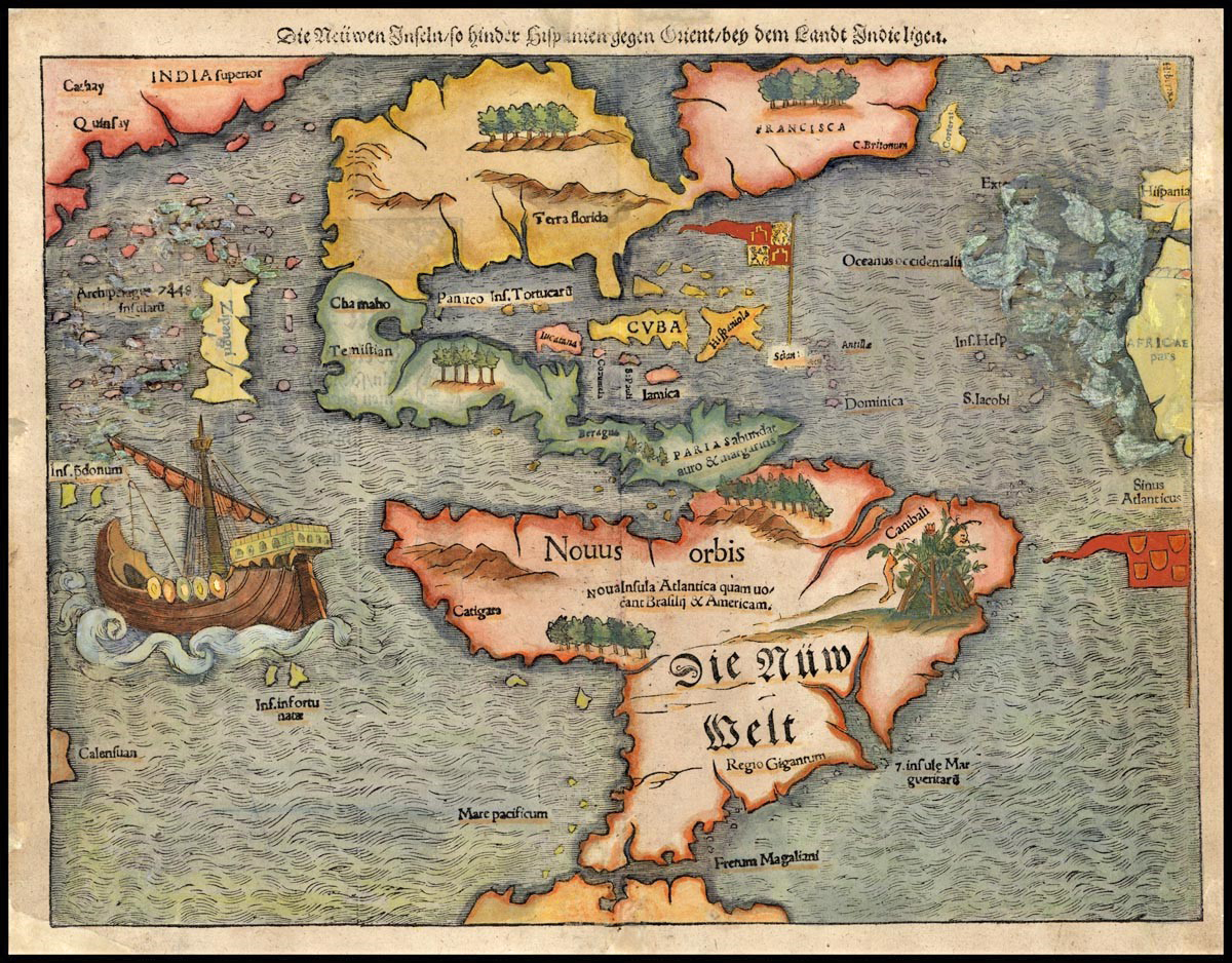
When the explorer Ferdinand Magellan finally made it ‘round the treacherous horn of South America in 1521, the ocean beyond seemed especially calm—so he named it the peaceful sea: Mare pacificum, the Pacific Ocean.
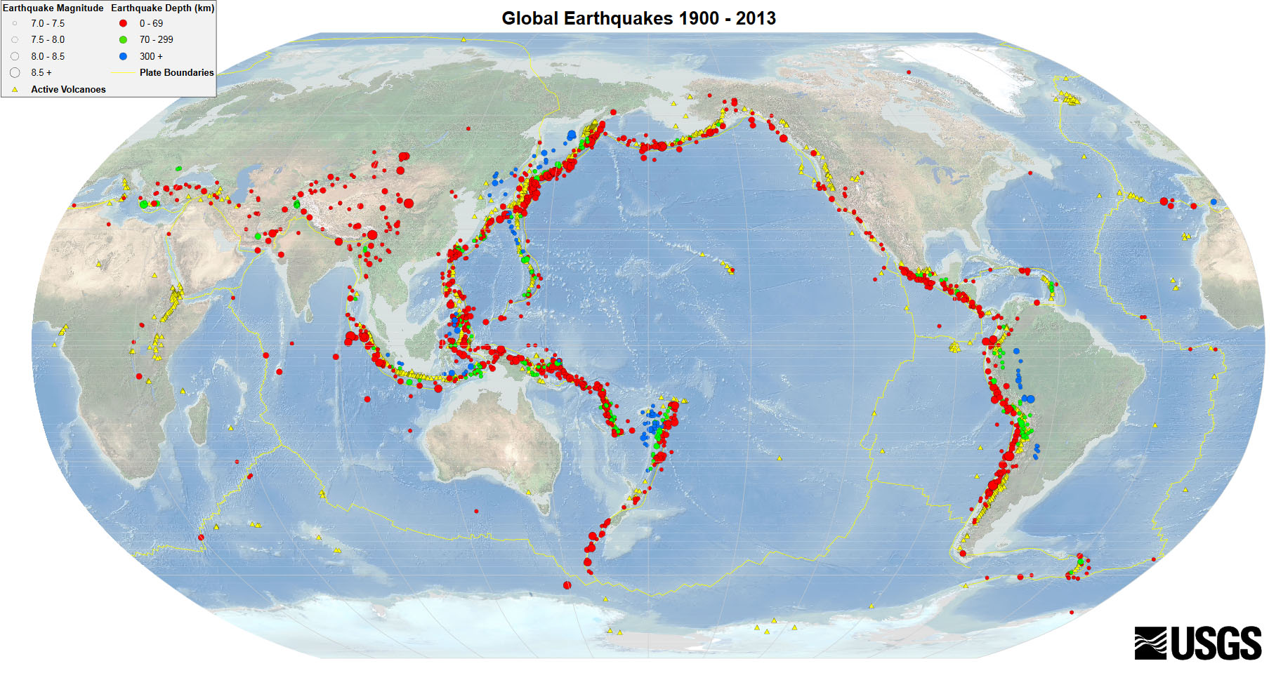
Little did he know the Pacific is anything but. It’s surrounded by more than 1,000 volcanoes that make up what’s now called the Pacific Ring of Fire—a geologically active strip 25,000 miles long, in places 300 miles wide, that borders the Pacific on three sides.
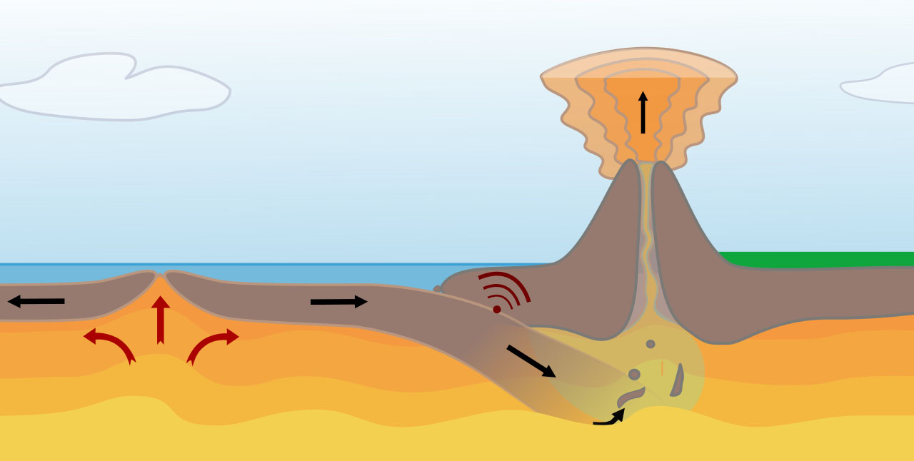
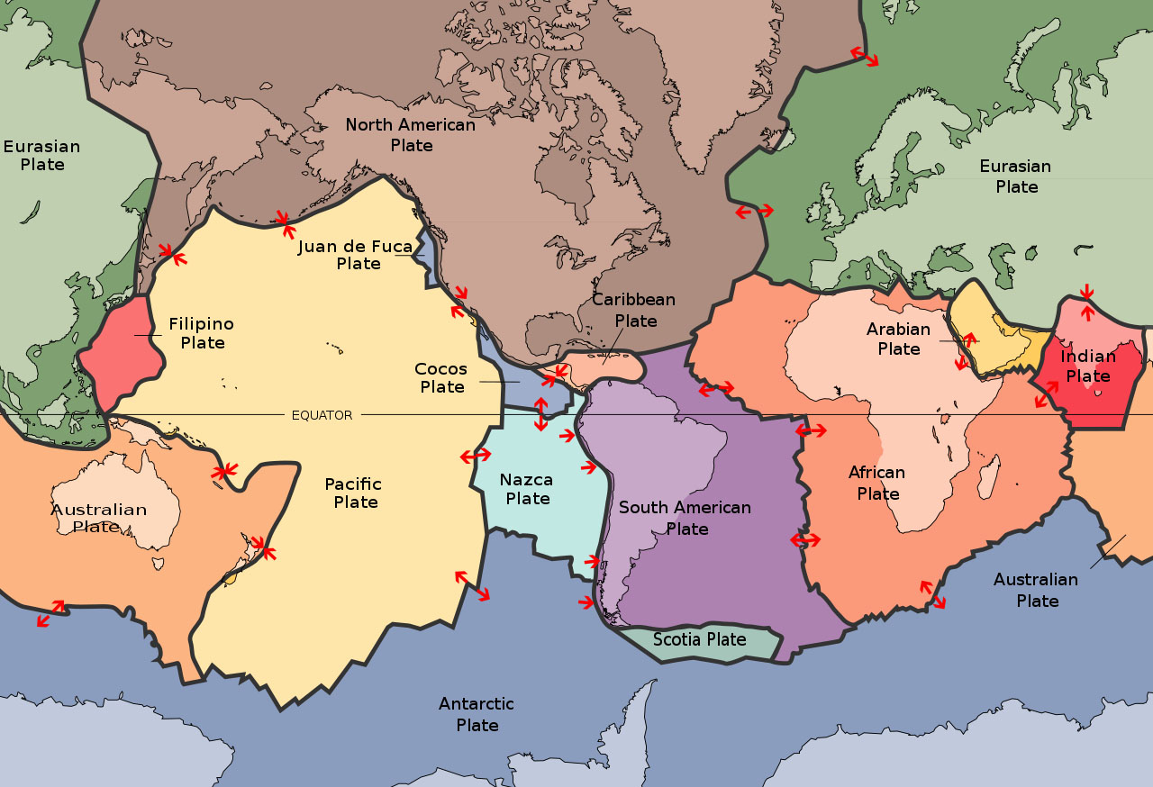
It would be more than 400 years later, in 1960, that scientists could understand what was going on: almost the entire periphery of the Pacific Ocean consists of plate boundaries where tectonic plates slide against or are pushed under other plates.
Whenever this happens, extraordinary energy is released.
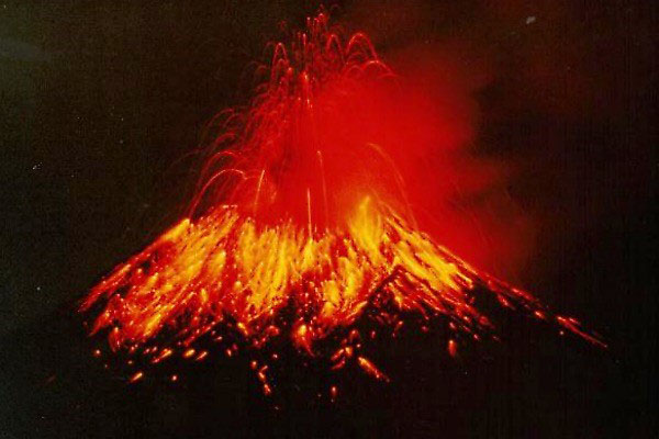
Two-thirds of Earth’s volcanic eruptions since the last Ice Age have happened in the Pacific Ring of Fire, including famous ones like Mount St. Helens.
Ninety percent of the world’s earthquakes each year happen along the edges of the Pacific.
This includes massive events, like the Tōhoku quake that caused the tsunami that flooded the Fukushima nuclear plant.
Of course, the Pacific is also vital for navigation and trade, fishing and national economies and provides a livelihood for millions of people.
Like most things in life, there are pros and cons.
Background
Synopsis: When Ferdinand Magellan first passed westward through the treacherous waters at South America’s southern tip, he named the basin for its peaceful waters—the Pacific Ocean. He had no idea that the largest and deepest of Earth’s oceans is surrounded by the violent geological hazards that comprise the Pacific Ring of Fire. The tectonic plates that form the Pacific basin are slipping and sliding against other plates at the periphery of the ocean, giving rise to beautiful mountainous scenery that disguises this volcanic and earthquake-prone terrain.
- Ferdinand Magellan found his way around the southern tip of South America into the ocean basin and beyond in November of 1520.
- His ships had to fight their way against a spur of the Antarctic Circumpolar Current that flows to the northeast along the east coast of South America.
- Then, to avoid the strongest part of the current to the south, they searched for passage through the straits at the tip of the continent that were later named the Straits of Magellan.
- Once the expedition found their safe passage through the Straits, they entered a beautiful calm ocean with favorable winds and named it the peaceful sea—or Mare pacificum—today’s Pacific Ocean.
- Little did Magellan know that surrounding the Earth’s largest and deepest ocean basin are nearly a thousand volcanoes along nearly continuous earthquake-prone subduction zones and transform faults.
- The Pacific Ring of Fire is 25,000 mi (40,000 km) long and up to 300 mi (500 km) wide, forming a belt around the western, northern and eastern Pacific.
- The tectonically active region includes the western coasts of the Americas, Alaska’s Aleutian Islands, Russia’s Kamchatka Peninsula, the eastern coasts of Japan, Taiwan, The Philippines, Papua New Guinea, several Pacific Islands, and New Zealand.
- Nineteenth century researchers first described the occurrence of volcanism surrounding the Pacific basin in publications as early as 1825.
- A Scientific American article named the phenomenon in an 1878 article titled "The Ring of Fire, and the Volcanic Peaks of the West Coast of the United States.”
- Publications about the horrific 1906 San Francisco earthquake recognized the relationship of the earthquake to the hazards of Pacific shorelines.
- As plate tectonics theory developed starting in the 1960s, the mechanism for the Ring of Fire finally came to light.
- Plate tectonics control the Pacific Ring of Fire.
- While oceanic crust is produced at the East Pacific Rise, a continuous ring of subduction zones and transform faults around the periphery of the Pacific constitute the Ring of Fire.
- Where oceanic lithosphere is consumed at convergent plate margins, oceanic trenches, volcanic belts, volcanic arcs, and back-arc basins form.
- While subduction has been underway in parts of the belt for much longer, the Ring of Fire has existed for more than 35 million years—since the start of the Oligocene Epoch.
- Volcanoes in the region are typically explosive andesitic stratovolcanoes, but a few subaerial basaltic shield volcanoes occur along the belt.
- Geological records show that two-thirds of all Earth’s volcanic events during the Holocene Epoch (the past 11,700 years) were located around the Pacific Ocean, associated with 850–1,000 volcanoes.
- The four largest volcanic eruptions since the end of the Pleistocene Epoch (11,700 years ago) occurred along this belt in Alaska, Kamchatka, Oregon and Japan between 8700–5480 BC.
- Today 75% of Earth’s dormant and active volcanoes—more than 450—are situated within the Pacific Ring of Fire and are situated near belts of extinct volcanoes.
- Famous volcanoes and regions in the belt include:
- Mount Saint Helens in the Cascade Mountains of the northwestern United States.
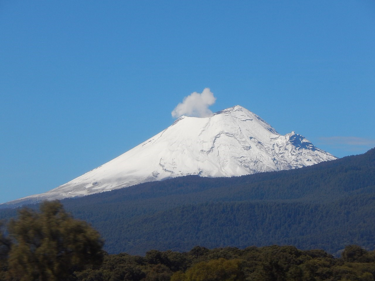
- Popocatépetl in the Trans-Mexican Volcanic Belt near Mexico City.
- Mount Fuji, Japan’s highest mountain, last erupted in 1707.
- The Aleutian Islands have 52 volcanoes, some of which are very active, such as Cleveland, Okmok and Akutan.
- The Andes are home to Ecuador’s Cotopaxi, Mexico’s Cerro Azul and Earth’s highest active volcano, Ojos del Salado, at 22,615 ft (6,893 m) on the Argentina–Chile border.
- Hunga Tonga–Hunga Haʻapai erupted in the Pacific nation of Tonga in early 2022, ringing Earth’s atmosphere like a bell.
- About 90% of Earth’s earthquakes occur along the Pacific Ring of Fire, releasing about 76% of Earth’s seismic energy each year. Since seismic magnitude measurement scales were developed in the 1930s, most earthquakes with magnitudes 8.0 and greater have occurred around the Pacific.
- In 1906, the San Francisco earthquake was in the range of magnitude 7.9. Located on a transform margin where plates are sliding past each other along the San Andreas Fault, the quake caused fires to break out that destroyed 80% of the city.
- In 1960, the Valdivia earthquake registered 9.4–9.6 in Chile and is still the largest on record.
- In 1964, the Alaskan earthquake recorded a magnitude of 9.2.
- In 2011, the Tōhoku earthquake with magnitude 9.0–9.1 caused a deadly tsunami that damaged the Fukushima Daiichi nuclear facility.
- The Pacific Ring of Fire is an important natural phenomenon to understand since it passes through at least 15 countries around the Pacific basin and has been home to some of Earth’s greatest natural hazard events.