
Earth is like an onion. The layer we live on, the crust, is like the onion skin. It represents less than 1 percent of the distance between Earth’s surface and its center.
Below the crust is the more malleable mantle, making up nearly half of Earth’s volume. Below that are the metal inner and outer cores.
In the late 1950’s, at the start of the Space Race, the U.S. and Soviet Union began a different contest: to see who could go deeper into the Earth, perhaps even all the way to the mantle.
The U.S. had barely begun when Congress pulled the funding. But the Soviets kept going.
They chose a spot in northern Russia above the Arctic Circle. The Kola Superdeep Borehole project housed scientists and drillers in that remote location from 1970 to 1994.
It took them 20 years to reach 40,000 feet, almost a mile deeper than the deepest ocean trench.
There, the heat was nearly double what they expected, and the rock became plastic, oozing back into the borehole. They tried for a few years to go deeper but could not.
Along the way, they discovered hot mineralized water, new species of microfossils, unexpected rock formations, and an array of gases.
Kola retains the superdeep record, though it only made it one-third of the way through the crust at that location.
We know more about the surface of the Moon than the bottom of the ocean or the inside of our own planet. There’s a lot more to discover right here on Earth!
Background
Synopsis: While the Space Race was going on in the last half of the 20th century, there was another superpower duel happening in the opposite direction, drilling to Earth’s mantle. Both feats challenged engineering capabilities, produced amazing discoveries, and went where no human had gone before. The earthbound mission proved more difficult: In more than 20 years of drilling, the deepest hole on Earth reached 12 km; whereas in about 26 years,Voyager I escaped the solar system, a trip of 16.5 billion km.
- Earth has layers. If you think of Earth like an onion, its crust is just the paper-thin outer covering, averaging just 0.66% of the average distance to Earth’s center.
- Earth’s average radius is 3959 mi (6371 km).
- Earth’s crust averages 25 mi (40 km) in thickness but can be quite thin near ocean spreading centers. Continental cratons have the thickest crust, thickening the most under mountain ranges. The continental crust is 45 mi (70 km) thick below the Himalayas.
- In 1909, a Croatian seismologist identified a marked change in density at the boundary between the rigid crust and the more ductile mantle. It was named the Mohorovičić Discontinuity to honor the seismologist and is called the “Moho” for short.
- Below the Moho is the malleable mantle, which makes up 40–45% of Earth’s volume, providing a dynamic cushion upon which Earth’s crustal plates jostle against each other.
- Below the mantle, generating Earth’s protective magnetic field, is the liquid metal outer core. At the planet’s center is its solid metal core.
- Of all these layers, humans have only been able to directly investigate Earth’s crust, so indirect geophysical evidence must be used to understand the nature of the mantle and core.
- In the late 1950’s, amid Cold War politics, two races started between the USSR and the USA, heading in opposite directions: the Space Race looked to the stars, while the much less publicized race to the Earth’s mantle focused on Earth’s interior.
- In 1957, Americans were the first to conceive of a project to drill deeper than ever before, through the crust and into the mantle. It was called Project Mohole.
- The plan was to take a shortcut to the mantle by drilling through thinner oceanic crust, but first scientists had to work out how ocean drilling could be done.
- How could a ship turn a drill bit without spinning in the water? The answer was dynamic positioning, using propellers mounted on the ship’s hull to fight the ship’s tendency to spin, keeping it centered over the hole. This technological leap was essential for the extremely precise offshore drilling technology used today.
- In 1961, the project successfully drilled a 601-ft (183 m) test hole in 11,700 ft (3600 m) of water into 44 ft (13 m) of basalt near Mexico’s Guadalupe Island.
- Ultimately, Project Mohole was defunded by Congress in 1966 because of scientific infighting about program goals and budget mismanagement.
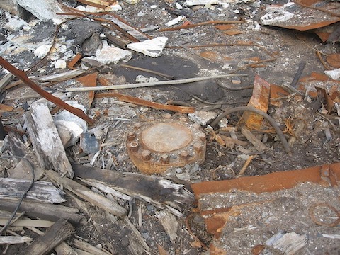
- Meanwhile, the Soviets planned the Kola Superdeep Borehole, which started drilling in May of 1970… and they kept drilling for about 20 years!
- The borehole is located 155 mi (250 km) north of the Arctic Circle on the Kola Peninsula of Murmansk province, Russia, near the Finland and Norway borders and on the Barents Sea.
- The trajectory of the hole was as vertical as possible to limit the torque on the drill string, but the project required the invention of a new type of drill bit.
- Previously, drilling was accomplished by twisting the entire drill pipe to turn the bit, but the drill string weight for this hole would be over a million pounds. So Russian scientists invented a rotary bit that spun at the end of the drill pipe. The drill pipe could then just slide down the hole while pressurized drilling mud caused the bit to spin.
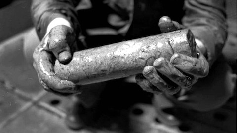
- Geophysical logging tools capable of withstanding the incredible pressures and temperatures in the borehole also had to be developed.
- These technologies led to the development of modern drilling equipment and well logging tools for oil and gas exploration.
- Originally planned to drill to a vertical depth of 49,213 ft (15,000 m, 9.32 mi), the borehole is just 9 inches (23 cm) in diameter and includes several sidetrack boreholes accessed through the original hole.
- Sidetracks are drilled out of the side of a wellbore when a hole must be abandoned because of various drilling problems.
- One of the sidetracks, the SG-3, extends 40,230 ft (7.62 mi, 12,262 m) vertically below Earth’s surface. It is the deepest point ever reached below Earth’s surface.
- The SG-3 drilled 4,022 ft (1,228 m) deeper than the deepest point in the ocean, the Challenger Deep section of the Pacific’s Marianas Trench which is 11,034 m (36,201 ft, 6.86 mi) deep.
- It is an impressive depth, but the wellbore extends only one-third of the way through the Baltic continental crust, and just 0.19% of the way to Earth’s center. To get to the center of Earth you would need to drill 520 times deeper!
- In 1989, the SG-3 reached its ultimate total depth when the downhole temperatures in the well increased from the expected 100°C (212°F) to 180°C (356°F).
- At these temperatures and pressures, the rock started to behave plastically, creeping slowly into the wellbore.
- The temperature was beyond the capabilities of their equipment, but the Soviets kept trying to deepen the well to the 15-km objective. They tried until 1992, but could never get deeper than the depth reached in 1989.
- Although there have been persistent rumors that drilling stopped when a super-hot subterranean chamber was breached and terrifying screams and wails were heard, the well never actually encountered Hell. The project actually ended when the Soviet Union fell and funding evaporated.
- The purpose of the borehole wasn’t just to drill 15 km, it was to investigate Earth’s crust—and the Kola Superdeep didn’t disappoint.
- Throughout drilling, hydrogen gas bubbled up from the well, as well as helium, nitrogen, and carbon dioxide.
- At 22,000 ft (6.7 km, 4.2 mi), 24 species of 2-billion-year-old microfossils were found intact, encased within organic carbon and nitrogen compounds that appear to have protected the fossils from the intense heat and pressure at those depths.
- Scientists were searching for the source of a seismic velocity change at around 23,000 ft (7 km, 4.36 mi), where they expected to find a boundary between granite and basalt, known as the Conrad Discontinuity.
- Instead, they found a transition from igneous granite above to metamorphic granite below. This showed that continental crust is composed entirely of granitic material, whereas oceanic crust is basaltic. This discovery helped to support the theory of plate tectonics.
- At this boundary, to the Soviet’s complete surprise, they found intensely fractured rock filled with hot mineralized water. The chemistry of the water suggests that it originated from mineral reactions in the crustal rocks trapped by an impermeable layer.
- The rocks at the bottom of the hole were 2.7-billion-year-old Precambrian (Archean) granites.
- Since the Soviet’s attempt, other ultra-deep wells have been drilled and planned, but none have surpassed the vertical depth of the Kola Superdeep Borehole.
- In Bavaria, the German Continental Deep Drilling Program drilled the Kontinentales Tiefbohrprogramm der Bundesrepublik borehole to 29,859 ft (9.1 km, 5.65 mi) before temperatures of more than 500°F (260°C) caused them to stop. Recordings of sounds from this well are part of a recent artistic project.
- Other wells in ocean basins that would drill through the crust into the mantle have been planned, and locations considered, but so far none have been drilled.
- Some oil wells have drilled longer wellbores in Qatar and offshore of Russia’s Sakhalin Island, but these wells are extended reach wells, with wellbores oriented at an angle or horizontal. Some of these have drilled more than 35,000 ft (10.7 km, 6.3 mi) laterally away from the surface location, an amazing feat in itself.