Credit: Jon Sullivan (pdphoto.org) / CC0, public domain, via Wikimedia Commons
For decades, Death Valley held a mystery that scientists could not solve.
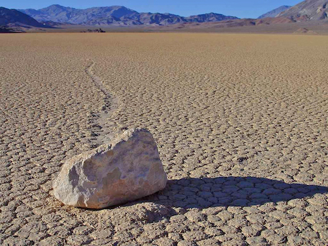
Large rocks were slithering across the valley floor, traveling hundreds of meters, leaving long tracks behind them.
But no one had seen them do it or could figure out how it happened.
So, scientists fitted rocks with GPS trackers and set up remote cameras to try to capture the rocks in motion.
Because the movements could be separated by decades, they expected this to be “the most boring experiment ever.”
But just two years in, they got very lucky: they were in Death Valley one cold December to change the GPS batteries … and saw the rocks move in person.
And figured out the rare combination of conditions that made it happen.
The valley floor had to cover with water, from rain or melting snow. The night had to be cold enough to form a thin sheet of ice across its surface.
The next day had to be warm enough to break up the ice into large floating panels, up to 50 feet wide.
Then a light, steady wind was needed to gently push the ice islands across the water, slowly nudging the rocks along with them, across the slippery mud bottom.
By midday, the ice and water had evaporated, and the scientists saw long trails behind the now displaced rocks. Their cameras and GPS trackers captured it all.
Background
Synopsis: California’s Mojave Desert is the home of Death Valley, the lowest, hottest and driest place in the United States. In Death Valley’s Racetrack Playa, boulders move inexplicably along winding paths, and no one had ever seen them move until curious scientists with GPS trackers solved the enigma.
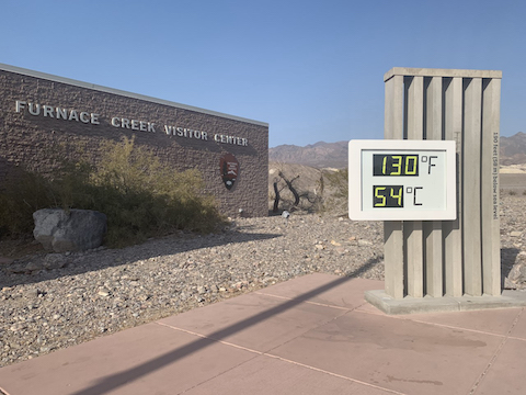
- Death Valley is the hottest, driest place in the United States, setting the world’s record-highest temperature in 2020.
- This is largely because it is the lowest place in the United States, sitting at -282 ft (-86 m) below sea level.
Credit: NPS/J. Jurado
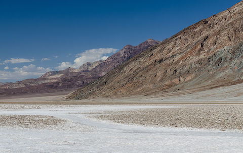
- Death Valley is a graben that runs north–south with an area of 3,000 mi2 (7,800 km2) in the northern Mojave Desert in easternmost California, near the Nevada border.
- Death Valley is enclosed by the Amargosa and Panamint Ranges to its east and west and the Grapevine and Owlshead Mountains to its north and south, respectively.
- Topographic relief is notable, with elevations in the Panamint Range exceeding 11,000 ft (3,353 m).
- Death Valley is perpetually dry because the rain shadows of four mountain ranges between Death Valley and the Pacific cause orographic lifting of west-flowing Pacific moisture that rains out along the western slopes of those ranges, leaving little to no moisture in the air reaching the graben. In some years no precipitation occurs.
- In summer, the deep valley traps superheated air between the surrounding mountain ranges that is reheated as the sun bakes the dark desert floor.
- Conversely, in winter, the valley traps cold air and temperatures as low as 15°F (-9°C) have been recorded during severe winter storms.
Credit: Tuxyso / Wikimedia Commons
- Death Valley National Park is home to an intriguing mystery—stones that move, leaving wandering trails behind in the parched clay of Racetrack Playa
- Racetrack Playa is a flat-lying dried-out lakebed that is 2.8 mi (4.5 km) long by 1.25 miles (2 km) wide, just west of the Panamint Range.
- People have noted the changing locations of these rocks and their trails since the 1940’s, but no one had ever caught them in the act of moving.
- Most of the moving rocks are 20 pounds (9 kg) or larger and leave wide tracks in the mud.
- Scientists never found footprints around recently shifted rocks, ruling out hoaxes, but theories abounded, including relocation by hurricane-force winds or dust devils, plowing by thick ice sheets and sliding on slippery algal films.
- A couple of researchers who had puzzled about the mystery of the Racetrack Playa stones since their childhood received permission from the Park Service to conduct a fun experiment.
- They embedded GPS trackers and time-lapse cameras in 15 stones that they carefully placed near rocks that had previously moved.
- They returned to the park to replace batteries in the trackers every few months, but nothing happened for two years.
- Colleagues called it “the world’s most boring experiment.”
- The scientists recognized that they might get usable data but were unlikely to actually observe the phenomenon, but they soldiered on.
Credit: Richard Norris, Scripps Institution
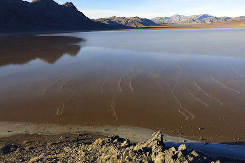
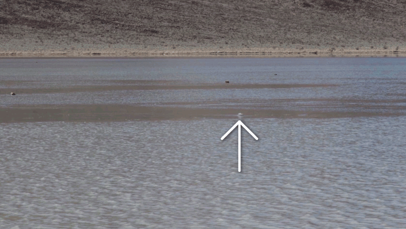
- Finally, in December 2013, they arrived to service the trackers just after a huge snowstorm and found the “super flat” lakebed filled with about 3 in (7 cm) of water from the melting snow.
- As night approached, temperatures dropped below freezing and ice began crystallizing across the playa.
- In the morning as the sun started shining, light winds began blowing at around 10 mph (5 m/s).
- As the ice began to crack, popping noises reverberated across the surface.
- Then, very thin (1/4 in [3–5 mm]) sheets of ice as much as 50 ft (15 m) across began to hydroplane slowly over the meltwater, pushing the slithering rocks along, leaving paths bulldozed in the muddy lakebed.
- The GPS trackers documented the rock movements, recording speeds of up to several feet per minute.
- Some rocks moved for as long as 16 minutes and as far as 200 ft (60 m), and some moved multiple times during the five floating-ice events that occurred over the next 10 weeks before the playa finally dried out again.
- Researchers determined that the last event like this had probably occurred unwitnessed in 2006, so the scientists were overjoyed to have been able to witness the rare event.
- The icy secret of Death Valley’s slithering stones was solved, introducing us to the amazing power of floating ice.
Credit: Jim Norris