Scientists have a new way to measure rain, or rather, rain intensity.
They looked at data from 185 weather stations across the globe, from 1999 to 2014, to determine how much rain fell in how many days.
They found that, on average, one twelfth of an area’s rain falls in its single wettest day, one eighth in its wettest 2 days, and half in just 12 days.
They decided to standardize this metric—the number of days it takes for half the rain to fall—as a way to gauge rain intensity in an area.
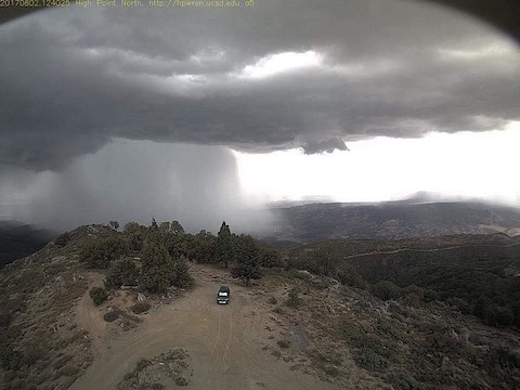
This is important because it’s intense rain that overwhelms the soil‘s capacity to absorb water, or the ability of a drainage system—of storm sewers, creeks and rivers—to carry water away, leading to floods, landslides and other impacts.
Scientists then projected what a warming atmosphere might mean to rain intensity.
Since warmer air can hold more water vapor, we could see more rain overall. This might be good news for places that don’t get enough rain.
But in already rainy areas, the increased rainfall may occur within its highest intensity rain days. The single wettest day could see 20 percent more rainfall.
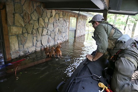
This could occur while population, and the cost of infrastructure, continue to rise in coastal cities around the world, putting more people at risk of flooding, with more need for better flood warning and management.
Background
Synopsis: Precipitation falls unevenly around the globe resulting in tropical rain forests and deserts. It also falls unevenly in time, causing wet and dry seasons as well as floods and droughts. Scientists have developed a new measure that can be analyzed retroactively: How many days does it take for a region to receive half its annual precipitation? Measuring how precipitation intensity has changed in the past around the globe helps researchers to better understand possible scenarios for the future.
- Atmospheric scientists have long tracked how precipitation varies geographically. They also know that extreme precipitation events vary in time, but quantifying and communicating the uneven timing and intensity of these rain events has been more challenging.
- Recently, researchers developed a new measure of the variability of extreme climate events: How many days does it take for half a region’s annual precipitation to fall?
- They analyzed daily rain data from 185 global weather stations for 15 years—from 1999 to 2014— and they used satellite data to fill in areas with fewer weather stations, like Africa and South America.
- They calculated that in today’s world a typical (median) location currently sees half of its annual precipitation in just 12 days.
- That’s 50% of the year’s rain happening in just 3.3% of the total year.
- That’s very skewed and amazing to consider. What do scientists expect will happen in the future?
- For each 1oC (~2oF) that the atmosphere warms, storms of the future will be able to carry about 7% more water vapor, and the resulting deluges are predicted to be increasingly more severe.
- Average wind speeds are expected to increase as ocean surface water warms.
- Simulations suggest that the number of days in which half a region’s rain will fall is likely to decrease compared to what we observe today.
- The researchers suggest that there will be little change in precipitation patterns most of the time, but society should prepare for a world where increased rainfall will be concentrated into just a few events that will be much more intense than today.
- How does that compare to recent weather data?
- Over the past 70 years, the average temperature of Earth’s surface rose 0.5oC (1oF), so today’s atmosphere can hold about 3–4% more moisture.
- Although the frequency of big storms has not increased, landfall speeds of tropical cyclones, also known as hurricanes, have been slowing compared to their speeds after landfall in the 1950s. North Atlantic cyclones slowed 20% while Pacific cyclones slowed 30%.
- Hurricanes are dropping 5–10% more rainfall on land than they did a century ago, as storms linger and inundate the land more thoroughly than in the past.
- Recent severe storms have resulted in devastating loss of life and staggering property losses around the world.
- But there is hope for improved prediction of extreme weather events in the future.
- Recent studies have shown that some weather patterns are connected via Rossby waves, wiggles in the jet streams, and that certain rain patterns in Europe may foreshadow future extreme events as far away as the South Asian summer monsoon of Pakistan and India.